8
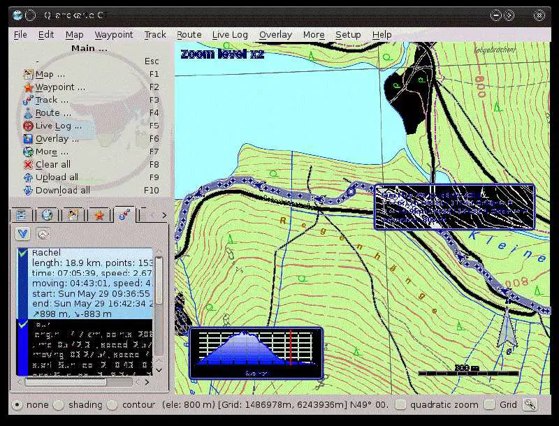
QLandkarte GTは、さまざまな地図にGPSデータを表示するための強力なオープンソースGISアプリケーションです。ターゲットは科学ユーザーではなく、屋外の愛好家です。ウェイポイント、ルート、トラック、マップを管理し、GPSデバイスに転送するために使用できます。
ウェブサイト:
http://www.qlandkarte.org/カテゴリー
ライセンスのあるすべてのプラットフォームでのQLandkarte GTの代替
7
7
6
Garmin BaseCamp
Garmin®BaseCamp®は、Garminマップ製品を表示し、地理データを管理するためのインターフェイスを提供します。BaseCampを使用すると、次のタスクを実行できます。
6
5
Viking GPS data editor and analyzer
バイキングは、GPSデータを管理するための無料のオープンソースプログラムです。
5
5
4
Garmin MapSource
MapSourceは、コンピューター上のウェイポイント、ルート、および追跡を作成、表示、および編集し、次の旅行のためにナビゲーションデバイスに転送できるソフトウェアです。
- 無料の個人用アプリ
2
0